
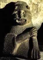
county list
![]()
|
Turn smartphone to horizontal
view.
Place-names in italics refer to listed entries. |
|
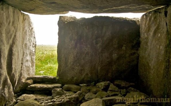
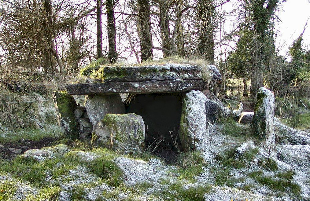
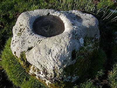
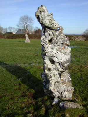
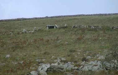
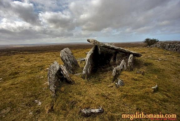
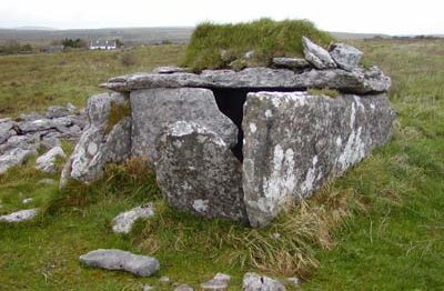
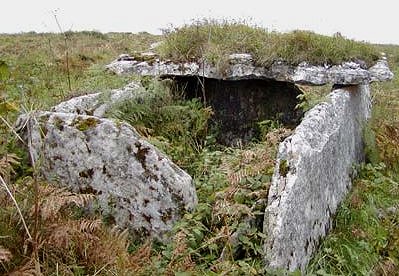
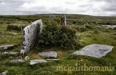
The chief interest of this ruined tomb is that the surviving side-stone of the chamber is perforated with a hole 60 cms in diameter, beside which is a matching round stone which would have plugged it. Perforations in transverse stones occur in Irish tombs, but rarely (if ever) in side-stones. And while a few bung-stones survive in the Paris-basin tombs of France, this - if it is genuine - is the only Irish example.
It is also easy to see, at this tomb, how the builders wedged the side-slabs into the cracks in the limestone during construction. ~8.5 km NE is the fine portal-tomb at Crannagh in county Galway. Ballycroum:
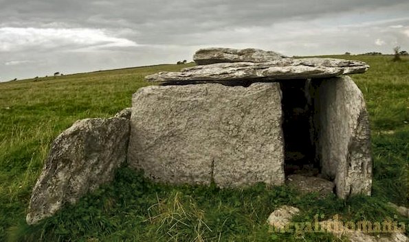
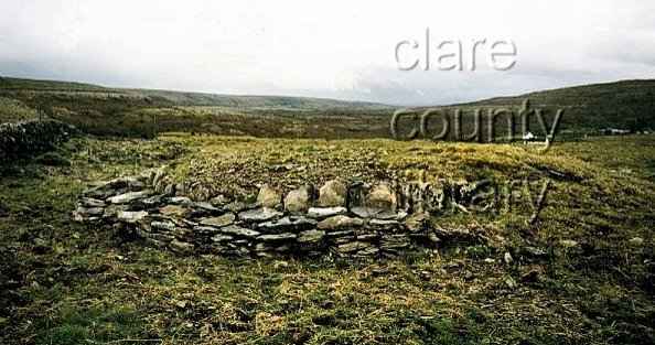
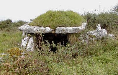
Wedge-tomb This well-preserved
wedge-tomb is also a holy well (tober) dedicated to the
sun (grían:gráinne, which features in several
Irish megalithic names). Its outer walls are still pretty much
covered by the surrounding bog, but looking inside you can see
that the gallery goes down a full metre below ground level.
Two fine overlapping roofstones - scattered with coins and little
offerings - cover the whole gallery. Looking in from the front
through one of the chipped away pieces of the septal slab that
seals it off you can clearly see the 'wedge' shape of the gallery.
Two stones to the front of the gallery form a small now-roofless
portico.
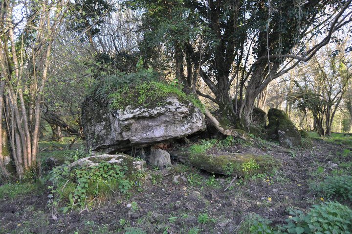
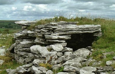
~ 13.4 km N by E in Bohateh North (R 678 906, sheet 52), and splendidly located on the hills to the north of Lough Derg is another wedge-tomb - which looks more like a megalithic kist. A huge squarish capstone leans against the one remaining wall stone to the west. The north and south wall stones are present but have collapsed beneath the capstone. An odd monolith stands just to the side of the main monument and an outlying slab stands 30 metres to the northwest. The chamber would have been about 1.5 metres square internally and about 1 metre high. It's interesting to note that several of the other many tombs around here are well set into the bog, but this one has definitely been built on what would have been a high spot before the bog developed.
~ Close by Bohateh is Cappaghbeha Mountain on which there is a ruined single-chamber portal-tomb/wedge-tomb hybrid (R 661 904) affording more spectacular views. Other very ruined megalithic remains are scattered about. ~ W by N of Ballycroum in Corbehagh (R 515 937) are the neat remains of a small wedge-tomb about 1 metre high and 3 metres long, on low pasture land. To the south the ground rises and there are exposed rock-surfaces, where engraving has been reported but never photographed.
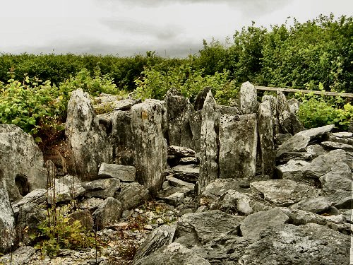
Ballyganner
South: Burren wedge-tombs click
on the thumbnail for a larger picture Situated
1.5 km NW of the prominent Leamaneh Castle, this fine but damaged
tomb has the largest chamber in the Burren, formed by 2 great
sidestones over 5 metres long and a neatly-fitting backstone.
The top of the S sidestone juts forward like a prow and bears
definite traces of dressing. The front (W) end of the chamber
is partly closed by a large slab which leaves a gap at the N
side. Over the W end of the tomb are two broken slabs which,
together with fragments inside and outside the chamber, formed
the huge roof of the tomb. There is a low septal sill-stone.
In 1955 a large bonfire was lit on the intact roofstone to celebrate
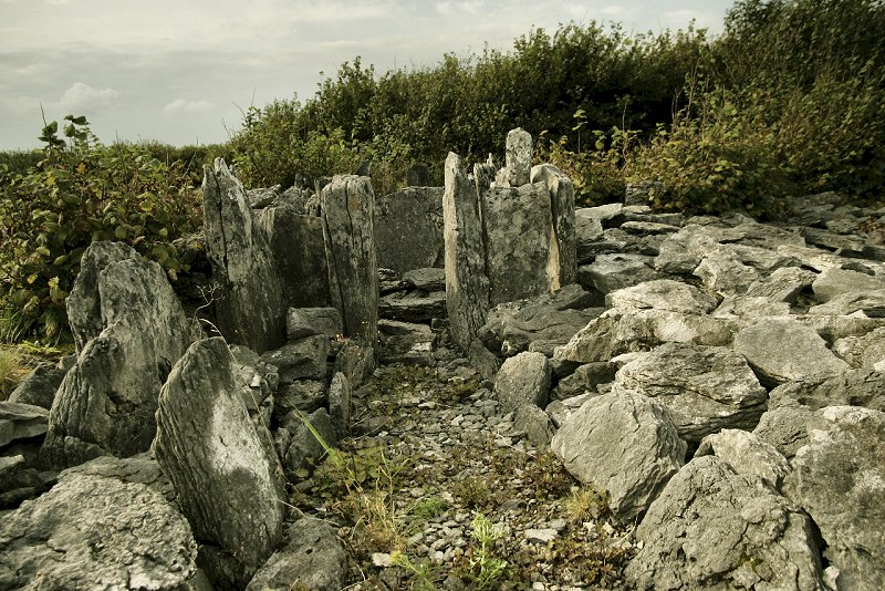
a Hurling victory. ~ Looking from the
above tomb West along its axis is another tomb in Ballyganner
North (R 223 953) now located within a cashel which has
incorporated some of its cairn. The gallery is some 4 metres
long, and from its E end (under the broken and collapsed roofstone)
a souterrain
runs.
My colleague
Ian Thompson (www.megalithomania.com) writes:
"The big Ballyganner South tomb (first listed above)
is built as if to dominate the area. Many Burren tombs seem
to be built on hillsides, but here all the tombs (apart from
the court-tomb) are built in prominent places. One of these
is so prominent that a cashel was built around it. The nicer
Ballyganner South tomb is built on a plateau but is raised up
significantly. The whole area is somewhat puzzling. Was the larger tomb built to dominate the court tomb builders? Or were the court-tomb builders intrusive ? What (if any) is the significance of the axis that the Ballyganner North (wedge in cashel) and the smaller Ballyganner South tomb share?" ~ 3 km ENE of the large Ballyganner South tomb, in Deerpark (R 248 950), is a charming but damaged wedge-tomb with a double roofstone and a 'soul-hole' at the back as at Baur South. ~ 2.4 km NW, in Noughaval (R 213 966), is a stone fort or cashel known as Cahercutteen, with exceptionally large stones and a fine flight of steps giving access to the cashel wall. ~ 1.2 km E by S of the large Ballyganner South tomb, in Clooneen (R 232 943), is another large wedge-tomb with a huge capstone and in a good state of repair. ~ 6.5
km ENE is Cahercommaun stone fort (marked Cathair Chomáin
on the map at R 282 965), about which my colleague Ian at megalithomania.com
writes:-
"Do not let the 'Cahercommaun
1 km' sign at the road stop you from trekking to this amazing
place. The path is fairly easy going apart from the last little
up hill bit that takes you onto the plateau upon which the fort
stands The fort itself is very ruinous, but what does remain
allows you to easily envisage its form and perhaps even its
scale. It was roughly D-shaped with the flat northern edge against
a high cliff face protecting that side. The central area (the
main stronghold) had walls 3 metres thick which protected huts
within the inner sanctum, and which still reach a height of
3.5 metres in places. Outside of this are two concentric areas,
within which you can still find the foundations of further huts.
Before you reach the main site you walk past huge rings of stones
marking where and outer settlement once stood, which in themselves
are quite fascinating when you start tracing the outlines of
the huts.
500 metres East of the fort and facing it (R 287 966) is a small and neat unmarked wedge-tomb." (See Tullycommon under Creevagh.) Ballykinvarga:
Stone fort A fine and large stone fort measuring 49 by 39 metres internally, and built of large limestone blocks, it has a fine chevaux-de-frise of closely-spaced upright stones to impede attack, including a larger standing-stone - part of a destroyed megalith ? The wall, surviving up to 4.5 metres high is typically built in vertical layers so that it is as much as 6 metres thick in parts. Remains of huts can be seen built against the wall inside. click the picture Ballynahown:
Burren wedge-tombs There are four wedge-tombs
in this townland, the most curious of which is located in a
basin hollowed out of the bedrock. Just one wall-slab and part
of the backstone stands now. Another slab lies to one side and
is probably the remains of the other side. There are traces
of the cairn outline, which was only a little larger than the
tomb itself. Directly in front of the tomb is an 40-metre square
expanse of exposed karst pavement, with many stones standing
up in the grooves.
~ 7 km ENE is another wedge-tomb at Derrynavahagh. Baur
South:
Burren wedge-tomb About 8 km WSW of Ballyvaughan, on the edge of a craggy plateau and just visible from a tarred track, this fine well-preserved wedge-tomb is built typically of thin Burren slabs and contains, unusually, a chamber within a chamber 2.4 metres long, both sharing the same backstone, and retaining its roofstones. As at Poulaphuca (2.5 km NE) the E end-stone has a corner chipped off.
~ 2.4 km N by W in Berneens (M 215 025) at a height of 190 metres is a very wedge-shaped slab-built tomb whose door-slab is missing.
~ About 1100 metres SW in Lissylisheen (R 211 992) is a small wedge-tomb with damaged gallery still embedded in its cairn, some 1.3 metres high and 4 metres in diameter. ~ 5.6 km S by E is the large but damaged tomb at Ballyganner South. ~ 1.2 km W by N is a fine stone fort at Cahermacnaghten, containing foundations of rectangular stone buildings.
~ 2 km ESE is another stone fort at Caherconnell, in use until (or re-used in) the 15th century. Following archaeological excavations from 2007 to 2009, a prehistoric chamber with a short passage was found 30 metres southeast of the fort, within which were burials dating from the stone age to the 17th century CE!
Caheraphuca:
Burren wedge-tomb 800 metres SW of Crusheen, this tomb is not very attractive (a stone wall has been built against it) but is included because of its accessibility. It displays the characteristic wedge-shape of these tombs. A long chamber of 5 stones supports 2 roofstones.
~ 3.3 km WNW by the roadside in Moyree Commons (R 363 891) is a ruined portal-tomb - one of only two in the Burren (the other being the much-photographed one at Poulnabrone). One portal stone stands over 3 metres high, but the other has broken at a height of around 2 metres, with the upper part leaning inwards against the taller one. The chamber is somewhat wrecked. To the front of the broken portal stone there is a very low stone which may be the remains of a small court in front of the entrance, whose doorstone is missing. A pile of cairn material lies to the N, and, curiously, a sturdy drystone wall has been built just 1 metre from the tomb.
~ 10 km NE is Derrycallan North wedge-tomb, county Galway. Caherdooneerish:
Stone fort At a height of about 210 metres above Black Head this fort is worth the climb up from the coast road for the Burren flora and the view over Galway Bay alone. The fort is built on a level piece of limestone karst and is roughly D-shaped. There is a terrace and traces of stairs. It is about 20 metres in diameter with jointed walls over 4 metres high and almost as thick in places. The stonework - of beautiful fissured Burren limestone - is better on the N and E sides than on the S and W, which, together with the irregularity of shape, suggests unskilful rebuilding at various times. Cappaghkennedy:
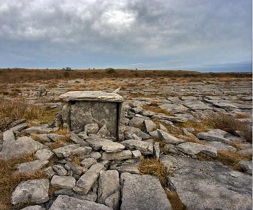
Burren wedge-tomb On top of a hill of deeply-fissured limestone surrounded by limestone pavements, this fine tomb is difficult to reach and requires some caution. It is almost complete, retaining its massive roofstone now broken in two. The walls are made from single slices of limestone. The backstone is missing, and so the rear section of the roofstone has dropped back slightly and now points into the air. The door-stone is a slab which is two-thirds of the width of the tomb, leaving a gap on one side. The interior rises to 1.6 metres, and the floor seems to have been paved.
There are three cairns on the hilltop, the highest one without grass covering it and bearing an Ordnance Survey trigonometrical marker. Any or all of them may contain tombs. ~ 4.4 km N in Coolnatullagh, on a south-facing slope that overlooks the little road running up the valley (M 310 031), is a tiny wedge-tomb with a roof-slab just 2 metres by one metre, and wall-slabs no higher than 50 cms. One of these has slipped, so that the roof has tipped; the other has been damaged, thus allowing access to the tiny gallery. The edge of the covering cairn can just be distinguished.
In the same townland, not marked on the map, is another cairn, apparently complete, and excavated in 1999. Unfortunately I have no co-ordinates, just the photo below.
~ 6.6 km SW is Parknabinnia wedge-tomb. Clooney:
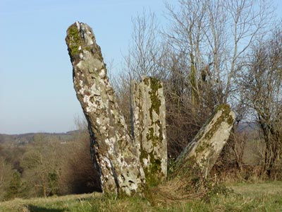
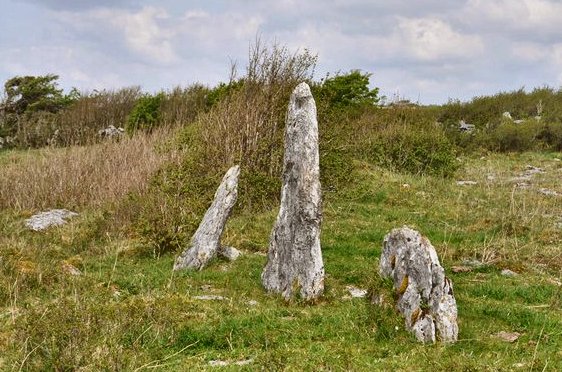
Stone-row Not quite on the top of a hill and clearly visible from a by-road, this fine alignment (NE-SW) comprises three stones around 1.7 metres tall and 2.5 metres apart. The two outer stones are charmingly askew. ~ 3.2 km E, and 1.6 km W by N of Tulla, by a hedge in a field to the left of a lane leading to Newgrove House (R 452 802), in Newgrove, is a small wedge-tomb which retains its roof, most of its outer-walling, and some of its circular cairn. Four mossy stones NW of the chamber may be the remains of a kerb. The roofstone is chocked by a small boulder resting on the N corner of the closing-slab at the W end of the tomb. A loose block of sandstone lying at the E end of the chamber with a round depression 27 cms in diameter and 9 cms deep may be a bullaun.
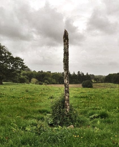
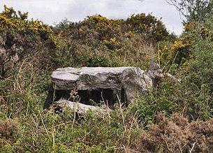
~ 4 km ENE, immediately S of a by-road in Tyredagh Lower (R 454 822) is a fine standing-stone some 3 metres tall and only 15 cm thick, 100 metres NW of which is a typical single-bullaun. ~ 4 km S in Ballyhickey (R 424 762), in a paddock next to a farmyard, is a fine wedge-tomb complete with orthostats and roofstones. ~ 13 km E on the boundary between the townlands of Clogher and Coolbaun (R 546 800) are the sad remains of a once-impressive portal-tomb, whose huge capstone sits in a wooded quagmire. ~ 5.6 km E by S, in a lovely setting next to a road in Milltown (R 468 799) are the neat remains of wedge-tomb whose chamber with grass-topped capstone and four orthostats survives. The picture below shows it from the back (East).
~ 4 km SSE is Magh Adhair inauguration-site (see below). ~ 9.6 km SSE in Knappoge or Knappogue (R 443 719) in a field to the west of the entrance to Knappogue Castle is a group of three stones (near the gateway) and a lone stone 200 metres away - perhaps the survivors of a row or avenue some 200 metres long. They are up to 2 metres high and of marvellously-decayed limestone. ~ 12 km SSE, on the W side of the railway-line beside a ruined church at Ballinphunta (R 479 616), the remains of a wedge-tomb and its circular cairn (completely buried in field-stones and undergrowth when I visited it in 1975) stand overlooking Craughaun graveyard. The surviving square roof-stone has a number of solution-pits, and beneath and behind it the chamber (containing a fallen, smaller, roofstone) extends almost 5 metres. The door-stone is impressive. Cloonyconry
More: Wedge-tomb Some 8 km from O'Briensbridge is a fine, well-preserved wedge tomb crowning a low knoll. ~ 9 km NW is the portal-tomb at Clogher (see under Clooney, above). ~1.6 km SW is another wedge-tomb at Formoyle More (R 592 707), almost hidden amongst bushes.
Creevagh:
Burren wedge-tomb Just W of a by-road across a stream and signposted, this is more complex a wedge-tomb than most, with grass-grown roofstone and impressive, tall, outer wall-stones. In front of the tomb is a tall slab nearly 2 metres high marking a possible antechamber. ~ 1.8 km NE in Tullycommon (R 287 966) is a tiny wedge-tomb not marked on the map, with a gallery only 1.7 metres long and 80 cms high. The tomb is 500 metres W of Noughaval stone fort (see under Ballyganner South).
~ 5.4 km WSW is the large wedge-tomb at Ballyganner South. ~ 3.5 km NW is the tomb or kist at Meggagh (see under Poulaphuca). Derrynavahagh:
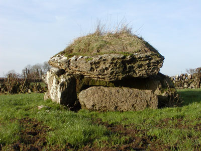
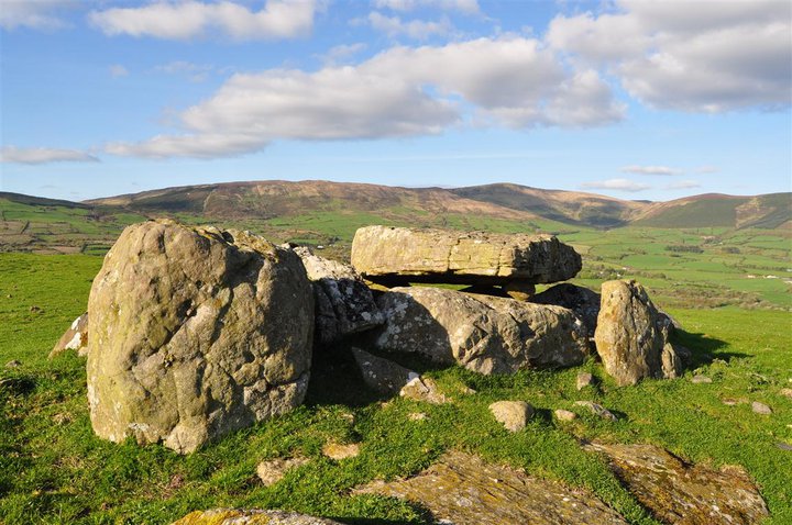
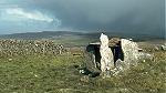
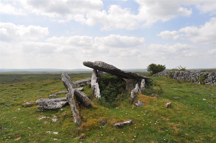
Burren wedge-tomb click
on the thumbnail for a larger picture Situated about 8 km WNW of Lisdoonvarna, this tomb, together with those at Baur South and Ballyganner North, is one of the finest of many wedge-tombs in the Burren of Clare. The flora surrounding it, and the superb view S over the remarkable limestone pavement (or karst) as far as the mountains of county Kerry (on a good day) add to its appeal. The chamber, which is about 3.4 metres long is covered at the W end by a large, broken, grass-covered roofstone measuring 2.1 by 2.4 metres. Some of the stones of the characteristic outer wall are higher than the roof. The E end is closed, and the entrance at the W end is partly closed by a high slab at right angles to the chamber. ~ 7 km WSW are more wedge-tombs in Ballynahown.
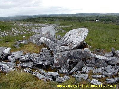
Fanygalvan & Cahermackirilla: Wedge-tomb, alignment, etc. A large hilltop wedge-tomb forms the centrepiece of a complex of monuments. It has a west-facing gallery 6 metres long, each side is formed by two slabs. The large wall-slab on the north side has collapsed inwards to about 45 degrees and is supported within the gallery by a small stone. This collapse gives the massive roof-slab a steep slope. It also is broken in two, with the front 1.5 metres lying on the ground in front of the gallery. When intact, it would have weighed somewhere in the region of 10 tons. At the front of the gallery the front slab is still in situ, but does not fill the whole width of the gallery. On the southern side in particular the remains of the double walling are good. The massive roof-slab would not have covered the back sections of the walls, which may have been extended later. There
are actually two wedge-tombs here. A few metres to the west
of the main structure there is another small, collapsed (earlier
or later ?) tomb on a different axis, whose roof-slab measures
around 2.5 by 1 metre, and lies on smaller slabs. ~ Just 50 metres to the east of the wedge tomb there is a large circle of stones that could be a fairly recent enclosure, but its proximity to the other monuments suggests that it is of similar antiquity to them. Just outside its southern edge there is a small cairn whose top has been removed, exposing a small body-sized kist, only 30 cm or so wide, formed by two limestone slabs 1.5 metres long, aligned north-south and blocked by smaller slabs across the ends. The cairn itself is about 1.5 metres high and 4 metres in diameter, making the kist relatively large for the size of the cairn. ~ 400 metres S - R 254 967 (GPS R 25383 96652) - and tucked up against a 3 metre bluff there is a sub-rectangular dry stone wall enclosure measuring about 6 x 4 metres. At one side there are two large, rounded boulders that seem to form an entrance. Just outside the opposite wall there is a rounded boulder on a raised section of limestone pavement. In the centre of the enclosure there is a large boulder that appears to have a small cavity beneath it.
~ In Cahermackirilla, immediately N of the wedge-tomb in Fanygalvan, is a NE-SW alignment of 3 stones - rare in this part of the country. (Though all over the Burren there are many small slabs set upright in the cracks in the limestone pavements - echoes of prehistoric stone rows ?) The middle stone is the tallest, at 1.6 metres high, with the smallest (possibly broken) stone at the southwest.
~ About 100 metres W is a large hut-circle some 10 metres in diameter, defined by small slabs set on end. There is a larger enclosure close by, and another hut circle lies close to the nearby chambered cairn. ~ At
R 25422 97121 (GPS) is another cairn, 2 metres tall and
about 10 metres in diameter. A field wall runs east-west across
the foot of its southern side. ~ Still in Cahermackirilla, at R 256 976, is a ruined cashel or stone fort occupying one of the highest spots on this particular hilltop. The walls on the west and north sides stand well over 4 metres in places. The south and east walls have disappeared and have been replaced by a thin Burren-style dry stone wall.The central area is raised at least 1.5m above the surrounding fields. Against the inside of the west wall there are the remains of two buildings, one wall standing 2 metres high. In the fields immediately to the west and east of the main structure there are a lot of smaller remains, indicating that there was quite an impressive little settlement around the cashel. ~ 2.1 km N of the Fanygalvan wedge-tomb is the tomb or kist at Meggagh (see under Poulaphuca). Inishcaltra:
Christianised megalith ? Also spelt Iniscealtra
and referred to as Holy Island, this monastic site (founded
in the 7th century) with Round Tower in Lough Derg has numerous
Christian monuments, mainly 12th century and earlier. There
are also no fewer than seven bullauns
and a perforated slab known as 'The Bargaining Stone'. Magh
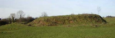
Adhair: Inauguration site Placed unusually in an amphitheatre of low hills, this eroded site, traditionally the Inauguration Place of the kings of Thomond has the usual features (like Tara) of large mound six metres high, and other earthworks in a place of older antiquity marked by megaliths. Stones are poking through the sides of the mound where the soil has eroded, because it is an earth-covered cairn-structure.
To the N of the mound is a large stone of purplish conglomerate with a bullaun in it, and to the W is a cairn over 3 metres high. These features are partly enclosed by an earthen bank on the E in which stand many stones, and partly enclosed on the SW by a stream on the other side of which is a two-metre high Standing-stone. Close by this site there were great gatherings down to the time of the Great Famine.
~ About 500 metres SSW is the tree-overgrown triple-walled Cahercalla - which is not marked on the map. For more information on both sites, and the link with Brian Boru, see the Voices from the Dawn website.
~ 7.2 km SSW, in the grounds of Drumoland Castle, 1.2 km NNE of Newmarket-on-Fergus, is Moghane or Moughaun Stone fort (R 407 706). A triple-walled construction, commanding extensive views over the Shannon Estuary, covering an area of over 10 hectares, is believed to be the largest hill-fort in the country. At the highest point is the inner cashel or citadel with walls over 3 metres thick and a diameter of over 100 metres. Near the fort, and almost certainly connected with it, was found the largest hoard of gold objects ever found in Western Europe. ~ 3.5 km NNW is Clooney stone-row (see above). Parknabinnia:
Burren wedge-tomb 2 km NNW of Killinaboy, this is one of the more accessible tombs in the dramatic landscape of the Burren, close to a by-road, remains of its cairn survive. The roofstone is over 3 metres long and now growing a crop of grass. The sides are formed of single massive slabs. The E (rear) end is closed and the front is partly closed, with a corner of the door-slab deliberately removed to make a 'spirit-entrance'. There are several tombs in the townland, at least one of which, visible from the tomb just described, at R 260 934, and now partly-incorporated in a wall, is very similar - though quite a lot of cairn survives, and indications of a second gallery.
The largest wedge-tomb, at R 258 933 is now only partly-roofed.
Another, recently excavated, proved to be a court-tomb. The area around Roughan Hill has the highest density of wedge-tombs in Ireland. ~ 500 metres NE in Leana (R 269 940), overlooking the monuments in Parknabinnia, and affording splendid vistas, are a round cairn and a wedge-tomb. The wedge-tomb's cairn is quite high, with its single roof-stone tipped at an interesting angle. The gallery is aligned roughly north-south, and all four walls are in place. At the north end two overlapping stones block the entrance as at the main Parknabinnia tomb. The round cairn is
25 metres in diameter and 3 metres at its highest, though its
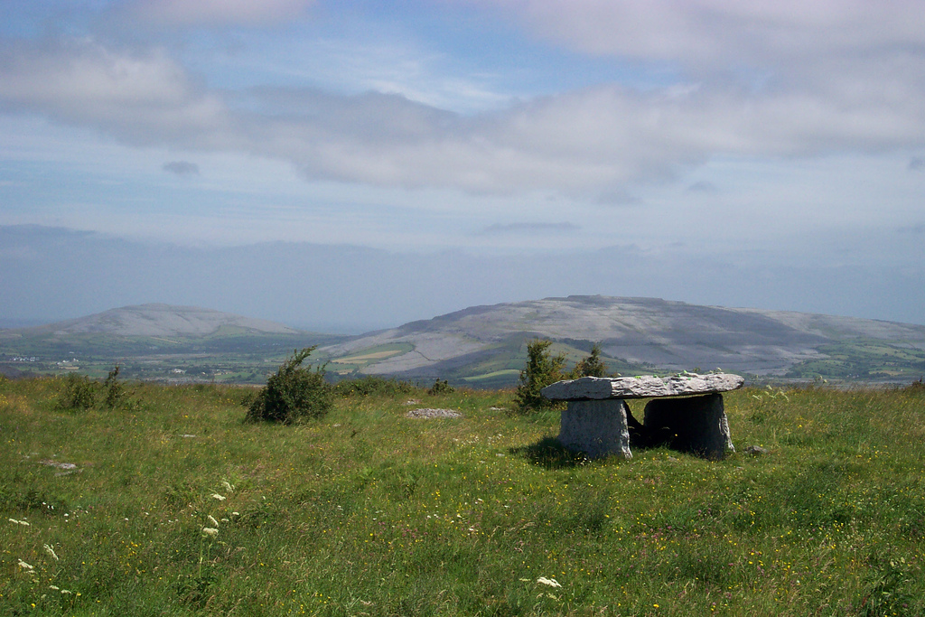
dominating position makes it seem higher. Poulaphuca:
Burren wedge-tomb About 6.5 km SW of
Ballyvaughan, this tomb has a very neat box-like chamber, closed
at the E end by a slab reaching to the roofstone which rests
on 2 long sidestones and the backstone. As at Baur South,
the E endstone has a corner chipped away.
~ 1.3 km N, by foot across treacherous limestone pavement, in Eanty More (M 264 004) is another box-like tomb. It has a superb and perfectly-preserved door-slab at the W end, with a much smaller 'soul-hole' on the top corner at the N. Part of the roof-stone lies inside the back of the gallery, and the back-stone has been moved and thrown down. Both these tombs resemble the box-like tombs of the French causses, where 'soul-holes' are a common feature, though usually in massive side-slabs.
~ 2.2
km SE in Rannagh East (M 284 006) is one of the smaller,
but better-preserved of the Burren tombs, with a gallery only
2 metres long and little more than 1 metre wide. The cairn survives
to a height of about a metre, not quite reaching the large roofslab
that covers the entire gallery, but has a chunk broken off.
~ 3 km S by W, just N of a by-road in Meggagh (R 258 988) is a neat little tomb not marked on the map. Only 1.4 metres square and 1 metre high, it looks like a small chamber of a court-tomb - or else it is a megalithic kist...?
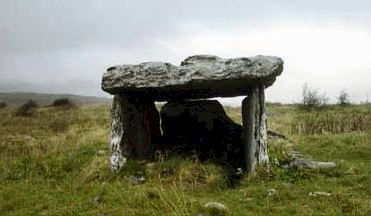
~ 10 km WSW is the fine tomb at Baur South. Poulnabrone:
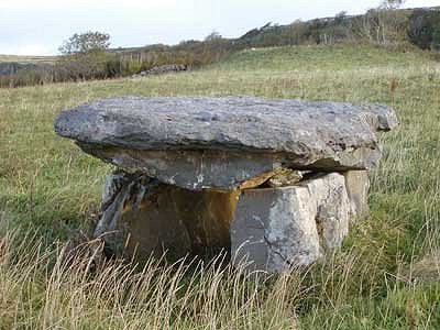
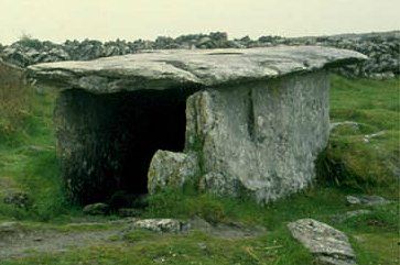
Portal-tomb Next
to the carved stones at Newgrange, this is the most-photographed
megalith in Ireland. It is a fine tomb set on the limestone
pavement to the E of the road from Killinaboy to Ballyvaughan,
in the centre of a low round cairn. The entrance faces N and
is marked by a low sill-stone. The thin roofslab, lifted to
a height of 1.8 metres by imposing slab-like portal-stones,
is tilted at the usual portal-tomb angle.
The tomb has recently been repaired after damage similar to
that at Ballyganner South (above).
~ 1.7 km S in Poulawack (R 233 988), and close to the more-visible Poulawack cairn (excavated and found to have been built in two phases: c.3350 and c.2000 BCE) is a rath and complex, accessible souterrain,.
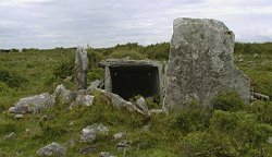
~1 km NNE is Cahercashlaun cliff-fort, a roughly-oval 'cashel' also containing a souterrain, and an outer defensive wall on the NE side. The entrance is a natural cleft in the limestone, and was originally roofed with slabs. ~ 1.6 km NNW (M 230 022) is a wedge-tomb in Gleninsheen - a small, box-like tomb resembling a stone kist whose E end is now open.
Remains of two other wedge-tombs stand nearby, one of which is just 100 metres to the E and consisting of one upright side stone, another one flat on the ground, and two oddly pointed overlapping stones that would have closed the (higher) west end.
Teergonean:
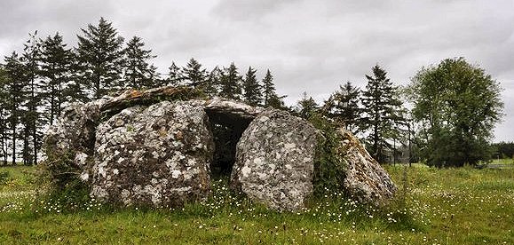
Court-tomb There is only a handful of court-tombs in Clare. This tomb sits in a hollow, beyond which is a view down to the sea. Two large chambers are entered through the remains of a court, whose tall portals and part of the left side survive.
|
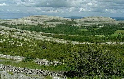
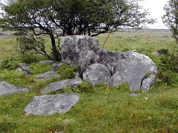
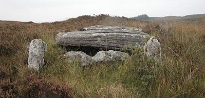
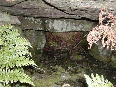
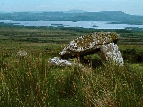
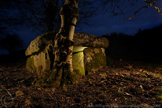
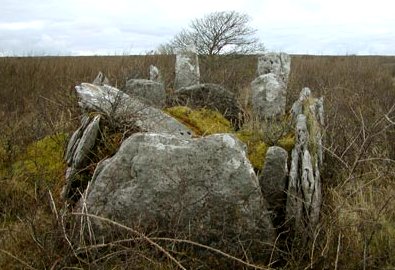
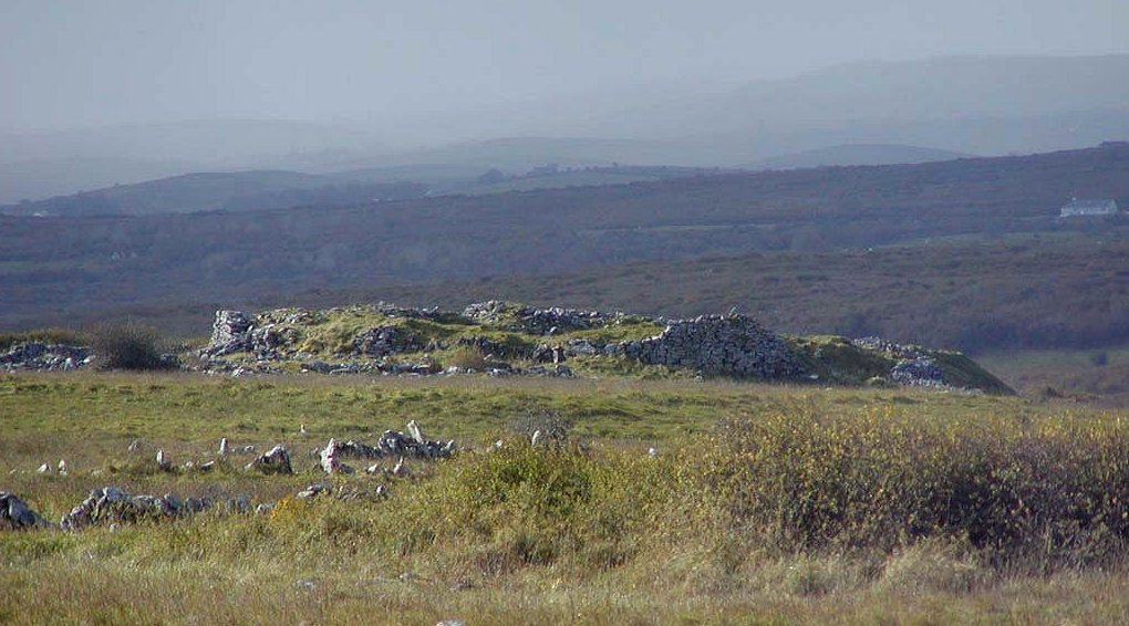
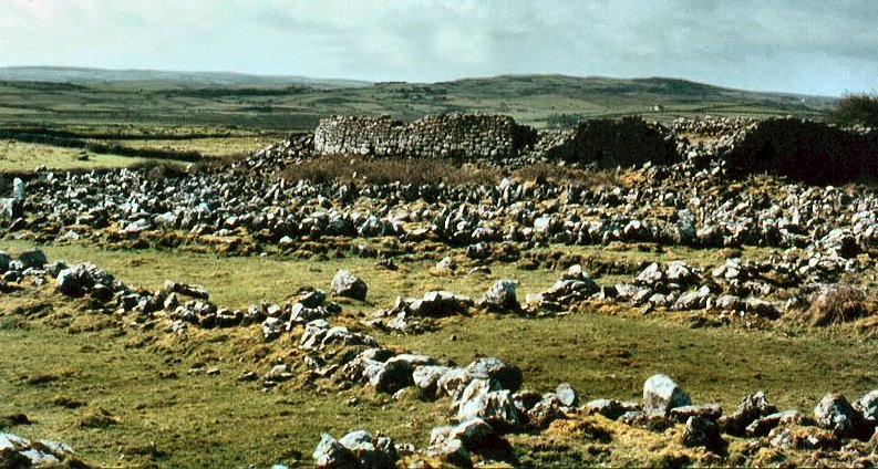
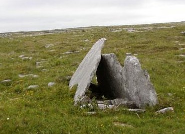
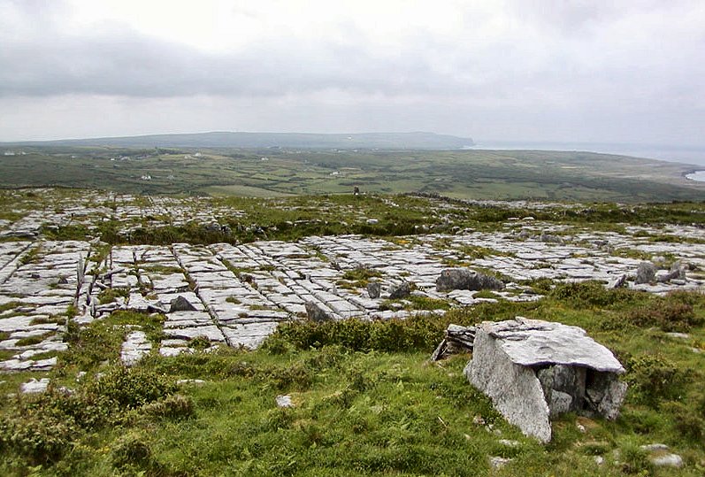
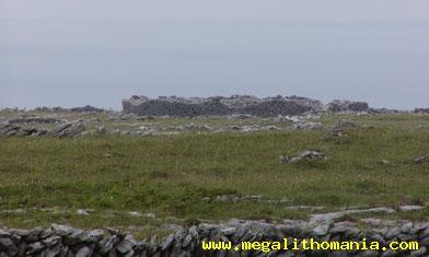
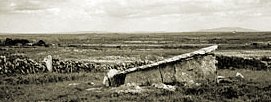
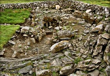 photo by Jim Dempsey