county list
![]()
|
Turn smartphone to horizontal
view. SELECTED SITES IN COUNTY LIMERICK Place-names in italics refer to listed entries. Convert Irish Grid references to Latitude/Longitude |
|
About 3 km NNW of Hospital is a remarkable and massive semicircle of low, rounded stones, very close together like stones of a kerb or the boulder-circles of Carrowmore in Sligo. Only two stones still survive on the other half of a structure which was 15-20 metres in diameter.
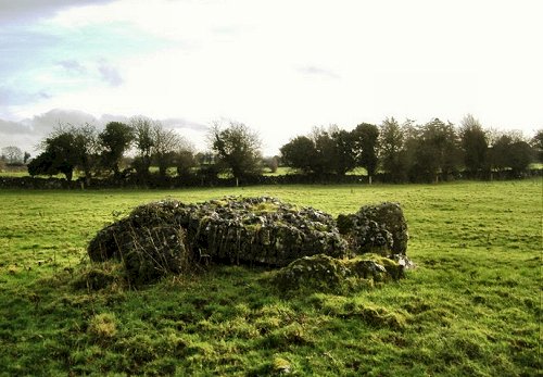
~ Some 3.5 km ENE of Hospital, in Cromwell (R 730 389), in the middle of a thicket, is Diarmuid & Grainne's Bed, a seriously overgrown wedge-tomb, the northern end of which is accessible. The gallery is now just 3 metres long, but may well have been longer. There is one large roofstone still in place at the N end, and another has fallen into the gallery, and now leans against the north side. Another stone that lies just outside the trees is probably another roofstone. There are good views S to the Galtee Mountains. On the top of the hill is a cairn and several defensive walls of various dates.
click
for another ~ 8.5 km SSW, on swampy ground in Ballinascaula (R 669 303), is another large trivallate earthwork some 5 metres high and around 30 metres across. The area is littered with evidence of ancient population. It may not have been only in the early 19th century that Ireland suffered from overpopulation...
~ 6 km W by N is the Líos at Lough Gur (see below). ~ 13 km N by W of Hospital is Knockroe, a significant twin-peaked hill with an impressive promontory-fort, a barrow and other remains, including standing-stones around its base. Castletown:
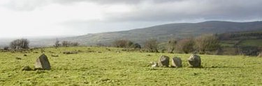
Alignment A charming little stone-row visible from a by-road. The tallest stone, just 1 metre high, is dwarfed by a large tree right beside it. The stone at the W end is, according to Derek Ryan, "a lovely craggy rock".
~ 17 km N at Clorhane and 4 km NNW of Adare (R 459 498), two fields in from a winding road, this low (and lowland) wedge-tomb (about 6 metres long) has an unusually craggy (and slipped) capstone. Some of the orthostats also are of decayed limestone. A short distance to the E is a flat-topped artificial mound or barrow.
Duntryleague:
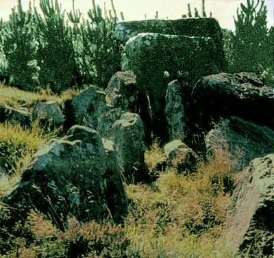
Passage-tomb On the top of Duntryleague Hill, a fine skeletal passage-tomb - denuded entirely of its cairn - still retains its long passage and a wider, cruciform chamber whose 3 roofstones are stepped one above the other in a style common in Brittany.
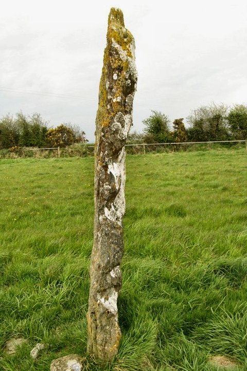
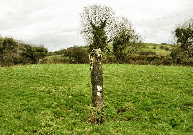
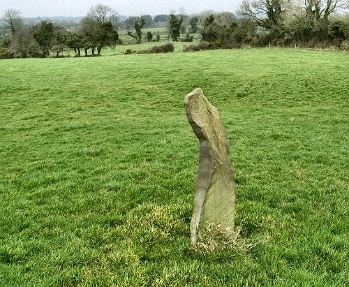
~ 800 metres NW in Lissard, behind a modern bungalow at R 772 288, is an unmarked standing stone, curiously blade-like and only 80 cms high.
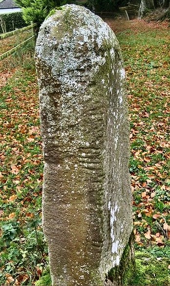
~ 3.8 km SW in a paddock off the front drive of Ballingarry House, some 2 km NW of Ballylanders (R 750 259) is an ogam stone 1.7 metres high, found on Knockfeerina in 1837 and subsequently moved. click
for another Lackanagoneeny:
Stone-row This alignment of three stones, all about 1.6 metres tall and set one metre apart, affords splendid views. A fourth stone stands some 5 metres to the SW, suggesting that there could have been seven or more stones originally.
~ 6.8 km N by E is Baurnadomeeny wedge-tomb, county Tipperary. ~ 6.9 km NW of Lackagoneeny (and 9.5 km SW of Baurnadomeeny in Tipperary) in county Limerick, in a corner of a remote field, is Garranbane "Giant's Grave" (R 749 573) - a wedge-tomb about 5 metres long, in good condition, originally dominated by Sliabh Eibhlinne and Sliabh Kimalta to the NW and N, both of which are now blocked by trees.
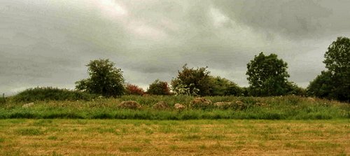
Lough
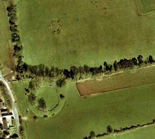
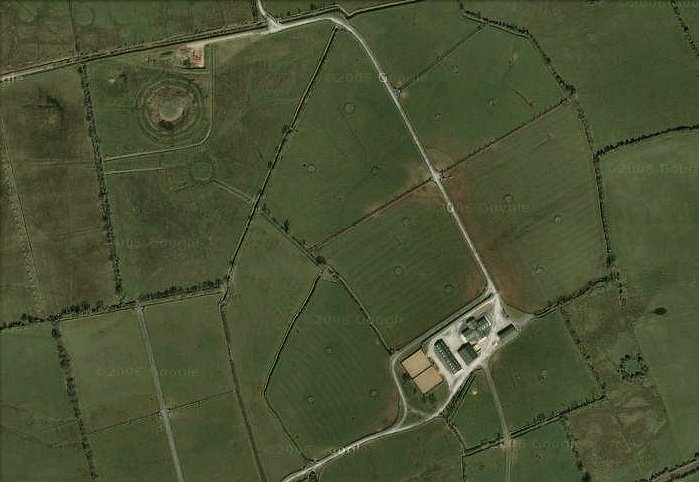
Gur: Stone circles, crannógs, tombs, hut-sites, etc. Lough Gur has a great concentration of prehistoric remains, including wedge-tombs, foundations of huts, stone circles, standing-stones and crannógs (artificial refuge-islands in lakes). These are spread over several townlands. The most
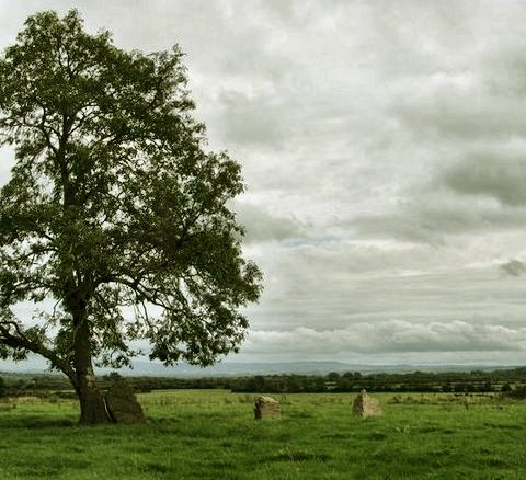
famous of these monuments is the Late Neolithic or very Early
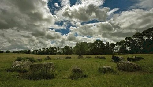
Bronze Age stone circle and henge known as the Líos
(= enclosure) in Grange townland, situated to the E of
the Bruff-Limerick road. Heavy stones stand shoulder to shoulder
against a massive bank of gravelly clay 10 metres wide, 1.3
metres high and nearly 70 metres across. Most are of local limestone,
but some are volcanic breccia from over a mile away. Of these
the heaviest stone just N of the entrance, known as Rannach
Cruim Dubh (prominent black stooper or hunchback), weighs
over 60 tons, and aligns with midsummer sunrise. Next to this
huge stone stands a small stack of stones, possibly the smashed
remains of a phallic pillar. This is now thought by some to
represent Eithne, the Irish Persephone - corn-child and concubine
of the dark god Crom Dubh. It is said that the whole embanked
enclosure was dug by Crom Dubh with his two pronged spear.
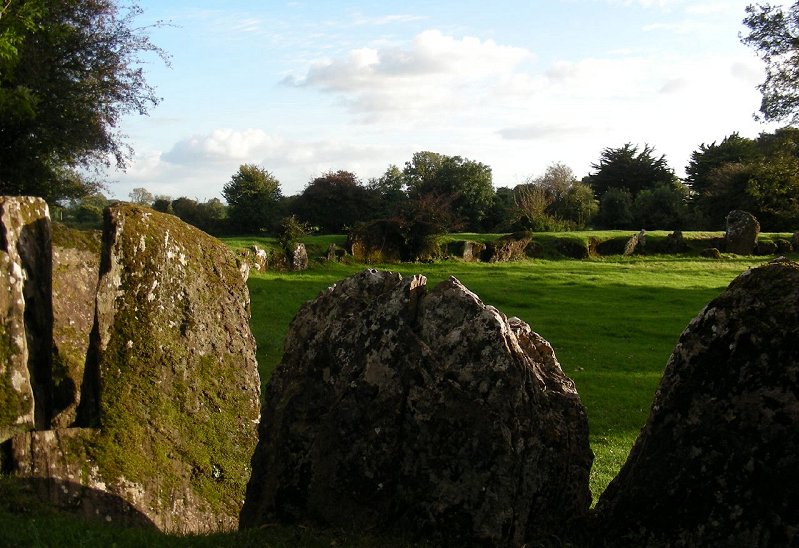
~ 100 metres NNE is a second circle, smaller (15 metres in diameter), unprotected from livestock, which can be reached through a purpose-built gap in the fence just over a low dry stone wall. It consists of rough and uneven stones with a gap where, it would appear, at least two orthostats have been removed (behind the cattle in the picture below).
~ Just visible over the hedge 100 metres to the south of Grange Líos and accessible through a gate in the same field boundary is Cloch a' Bhíle, or the Tree of Life, said to be a lithic manifestation of the supernatural tree that mythically grows at the bottom of the nearby Lough. In its gnarled, bramble-protected mossiness it does resemble a trunkless tree. The farmer who now looks after much of the land around Lough Gur sells a small but very informative booklet on the whole area written by O’Kelly who excavated the site in 1939. The fence surrounding and protecting the circle was erected at Tim’s own expense and so he asks for a contribution of only two euros from adults visiting the site. Please do respect this if he is not around, so that the site can continue to be kept tidy for all to enjoy. ~ Near the NW corner of the Lough is a stone-built crannóg now surrounded by marsh instead of water. ~ To the S of the road skirting the S shore of the Lough in Loughgur townland is a fine wedge-tomb some 9 metres long, with a slab-roof gallery and a separate chamber instead of a portico at the SW (front) end. ~ About 750 metres SW, on the same side of the same road is another - ruined - wedge-tomb, known as Leaba na Muice (The Pig's Bed). ~ On the other side of the Lough are more standing-stones, circles, and another crannóg, as well as stone forts, and neolithic house-sites. The circles include Loughgur P. (R 654 412), which is another fine henged monument, somewhat overgrown, whose banks are faced on both sides with large stones, although they are poorly visible on the south side. There is a central structure within the enclosure that looks like a small stone circle, but might be a hut site. Unfortunately, field-fences impede free internal, access, the banks have been planted with thorn trees and the inner circle is full of saplings. There are two apparent entrances into the inner area - one on the south and one to the north. ~ The visitors' centre is better than many. ~ Beyond the Lough Gur complex, but in the general area, are several standing-stones, including 'those at Moohane (R 669 410) 6 km NNE of Bruff (1.6 metres high), Tynacocka (R 623 345) 2 km S of Bruff (1.2 metres high), Anglode (R 651 505) some 2.5 metres high on a hill near power-lines and the school of Bohermore on the outskirts of Limerick City - and, best of all, Ballinculloo (GPS R 5747 3339), 6 km SW of Bruff: a slab some 3 metres high, not marked on the map, yet quite visible beside a minor road. On one of the broad sides it is interestingly (and naturally) uneven. Like many stones around Bruff it affords a good view of the significant Knockfeerina (also known as Knockfierna). click
for another
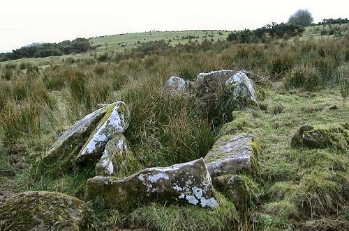
Tinnakilla:
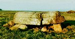
Megalithic kist or Wedge-tomb click
on the thumbnail for more This
monument - (about 6 km ESE of Glin, just S of Ballyhahill) -
is not marked on the map, nor have I visited it. It is included
because I found two photographs of it online. The first, from
FlickR shows it now, somewhat at risk. The second is
a black and white photo from Limerick City Museum, showing it
before the comparatively recent splitting of the capstone. From
the photos it is impossible to say if it is the remains of a
wedge-tomb, or a large megalithic kist. It was eminently suitable
for use as a Mass Rock in Penal times. I am indebted to Derek
Ryan for the identification of the townland.
|
 photo
by Derek Ryan
photo
by Derek Ryan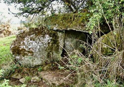
 photo
by Derek Ryan
photo
by Derek Ryan
 photo
by Derek Ryan
photo
by Derek Ryan