
county list
![]()
|
Turn smartphone to horizontal
view. SELECTED SITES IN COUNTY ROSCOMMON Place-names in italics refer to listed entries. Convert Irish Grid references to Latitude/Longitude |
|
click
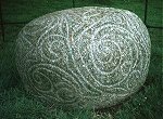
on the thumbnail for larger pictures This beautiful egg-shaped stone, similar in material (granite) and style ("La Tène" curvilinear) to the phallic one at Turoe in county Galway, lies beside the avenue in Castlestrange Demesne (private estate), 2.4 km NW of Athleague. Sixty cms high and 90 cms long it is decorated all over with a continuous swirling pattern which is engraved rather than carved in relief like the Turoe stone. Since I first saw it in 1971 it has sadly deteriorated due to national neglect.
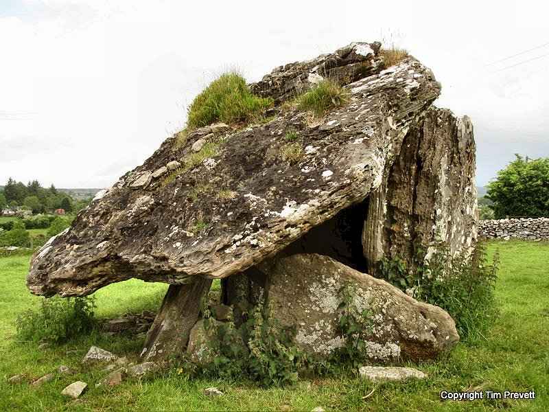
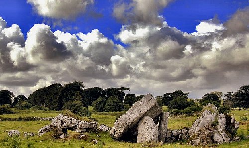
Drumanone: Portal-tomb In a field immediately N of the Sligo-Mullingar railway, to the N of the Boyle-Tobercurry road, this tomb (also known as Tinnacarra or Ballynanultagh Dolmen) comprises a polygonal chamber and a huge roofstone measuring 4.5 by 3.8 metres, which has slipped back from unusually high (2.4 metres) portal stones, between which is a massive doorstone entirely blocking the entrance. The sides of the chamber are formed by single stones, between which is a small, low boulder. The present circular outline of the surrounding mound is due to cultivation.
Glenballythomas:
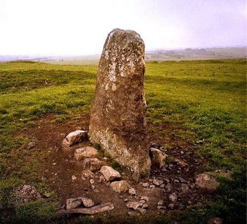
Souterrain and cave. 1.6 km S of Rathcroghan crossroads and approached by a tarred lane leading off the Rathcroghan-Lissalway road, is the damp and magical Cave of Cruachú, known also as Oweynagat or Cave of the Cat: a deep limestone fissure into which the visitor may descend from a circular ring (perhaps an Iron age burial place) through a dry-walled souterrain some 3.6 metres long, roofed by large lintel-slabs, two of which bear Ogam inscriptions. Only the most intrepid should venture further.' The area around Rathcroghan crossroads is rich in earthworks associated with Cruachain, seat of the Kings (i.e.warlords) of Connacht, and scene of the ritual drinking-feast and king-making marriage to the goddess Maeve (Medbh) known in England as Queen Mab. The name Cruachain also refers to the North Roscommon limestone plain. There is a Visitor Centre at Tulsk. ~ 800 metres SE is Knockannagorp (Hillock of Corpses) alias Dathí's Grave, a small ring-ditch in the middle of which is "Dathi's Stone", a 1.8 metre high, brownish slab said to mark 'the grave of the last pagan king of Ireland', an entirely mythical personage. The significance of the stone remains a mystery.
Click here for an historical tour of the complex on the 'Voices from the Dawn' website.
Scregg:
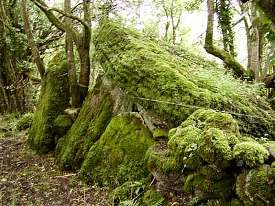
Passage-tomb 4 km W of Lecarrow, on a rocky knoll to the E of a by-road, is" The Cloghogle Stone" (cloch togálach = raised stone) -a small picturesque chamber 1.2 metres high inside, composed of single slabs, is partly closed at the entrance by a stone 70 cms high. The cairn has mostly disappeared.
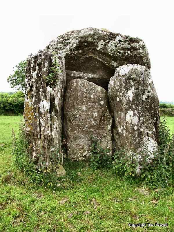
~ 15 km SSE (6 km WSW of Athlone) in Mihanboy (M 986 403, sheet 47) is a ruined portal-tomb, originally supported on portals 2.3 metres high, whose backstone has collapsed - thus causing the roof-stone to slide back, taking the door-stone with it.
|