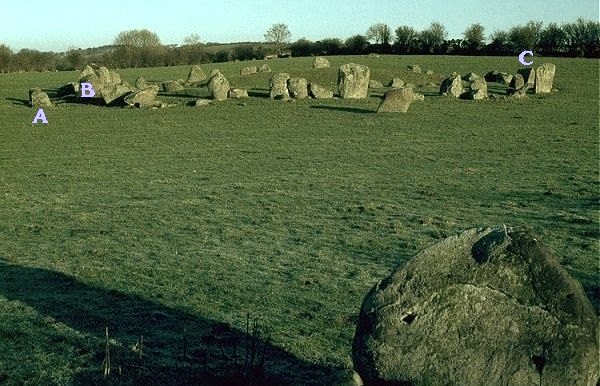
Ballynoe, county Down - viewed from the South.
Nearest town: Downpatrick
A portalled entrance at the W with stones 2.1 metres apart (marked with the
letter A) faces (but is not actually aligned) West
- i.e. on the rising and setting sun half-way between midwinter and midsummer
(around March 21st).
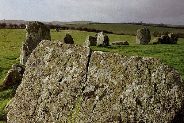
A slightly off-centre axial stone with a bevelled horizontal edge is just behind
the portal stones (behind the letter B).
Directly opposite the Western flat-topped stone is another (below the letter
C) not-quite-aligned to the E
(on the rising equinoctial sun) and the circle at Swinside in Cumbria - 190
km across the Irish Sea -
to which the Ballynoe circle is thought to be twinned.
The Ballynoe circle lies at 54° 17' 35" North.
The Swinside circle is at 54° 16' 56" North.
In between them, on the Isle of Man, lies Ballafayle Long Cairn at 54° 17' 1"
North.
On days of good visibility the mountains of Cumbria are visible
from the nearest high ground
(about 8 km NE of Ballynoe), as well as the nearer Isle of Man, the peak
of whose highest mountain, Snæfell,
is slightly South of the relevant latitude, at 54° 15' 52".
On some days the Isle of Man and Cumbria seem to be half as far away as they
actually are.
But the stone circle has no views to the east, and is virtually invisible
from all eastern and south-eastern approaches,
and there is no view from it either to the nearest prominent megalithic tomb
at Slievenagriddle,
nor to the significant marker of Snæfell on the Isle of Man - just as
at Swinside in Cumbria there is no view to
the west,
though the Mountains of Mourne rise dramatically from the sea to the SW,
providing a splendid backdrop to the monument.
Click on the picture to see the same view in snow.
Click on the camera for a ![]() view from the North-east.
view from the North-east.
The axial stone (marked B above), with the Southern outlier in the distance.
<< BACK<<
