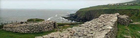
Dunbeg, county Kerry
V 350 973 - Sheet 70
Nearest village: Ventry
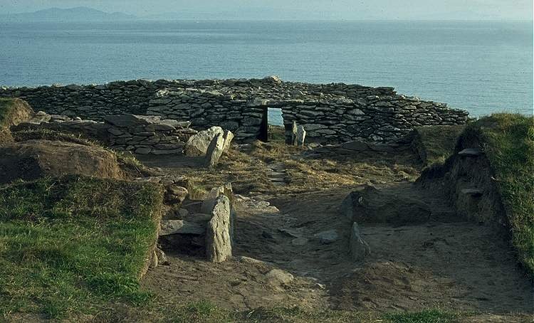
The picture above was taken some 25 years after the picture below:
a view across excavations to the restored dry-stone wall
in the top picture, with elaborate entrance and internal terraces.
The side-walls of the long, lintelled entrance are recessed to hold sliding
defensive beams,
and have guard-chambers on each side with squint-holes for surveillance of
the passage.
From below the passage a long souterrain leads out at least as far as the second
of 4 parallel defensive stone-faced banks with ditches.
You can see some of the lintels of this souterrain in the
centre of the picture.
Inside the fort are remains of a large circular stone hut (or clochán
shown in the top picture) which has a square interior.
Part of the fort fell into the sea in 2014.
For comprehensive views of the fort after recent excavation
and basic security precautions,
but before the cliff-collapse -
see the Voices
from the Dawn website.
<< BACK<<
